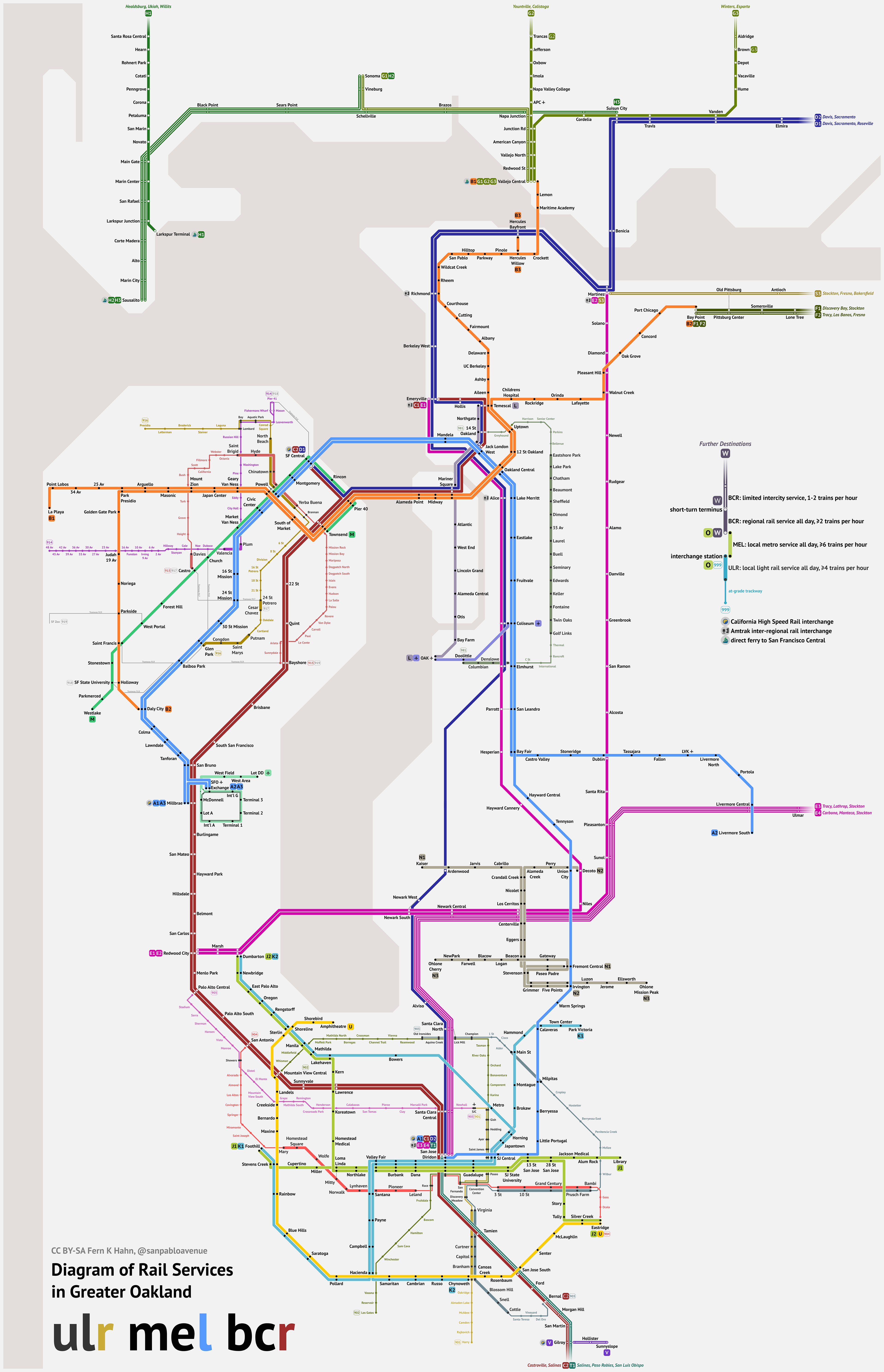

My first transit maps were of unrestrained fantasy networks for various North American cities. What they lack in transit planning value, they've got in complexity, so they served well to develop my basic design skills.
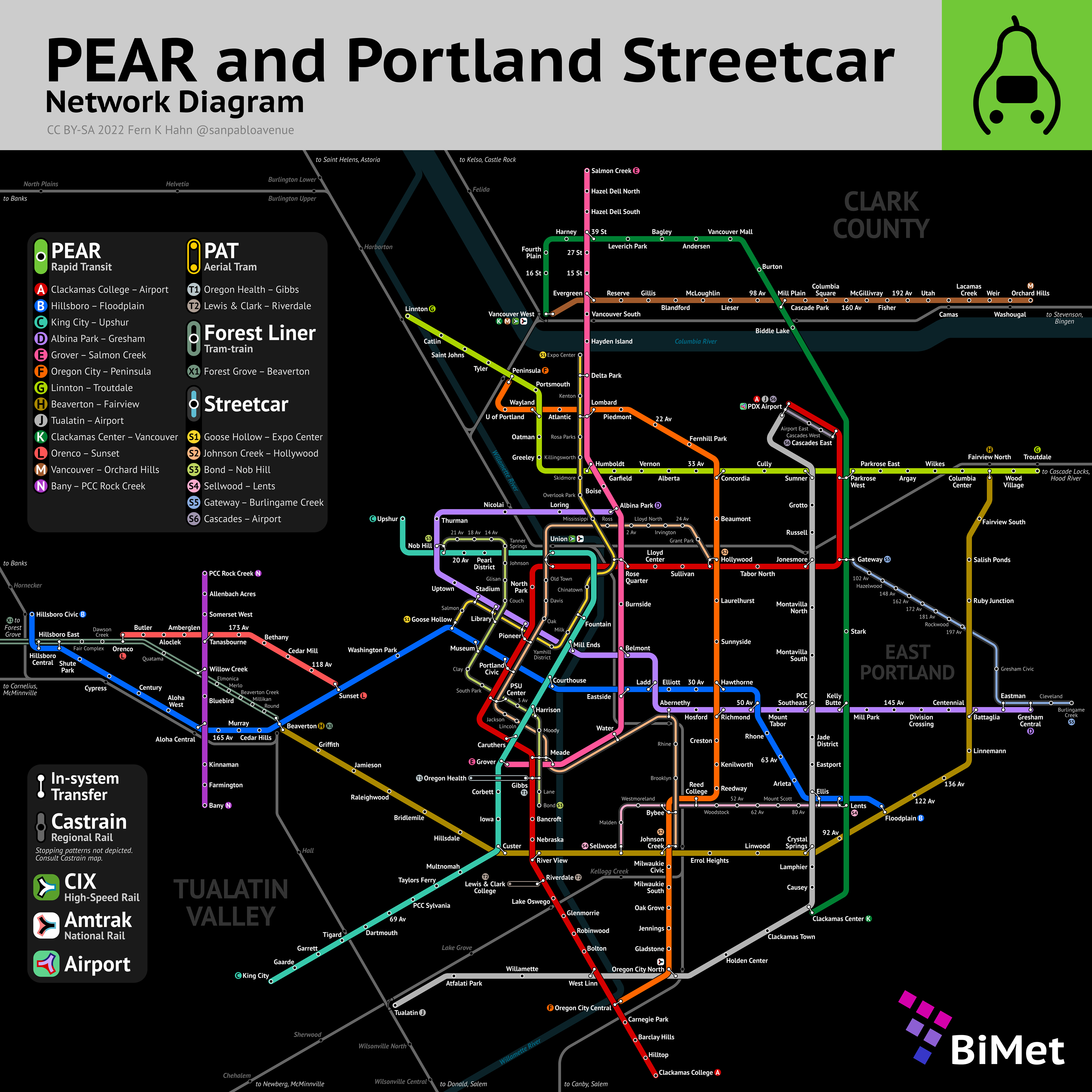
Portland | March 2022
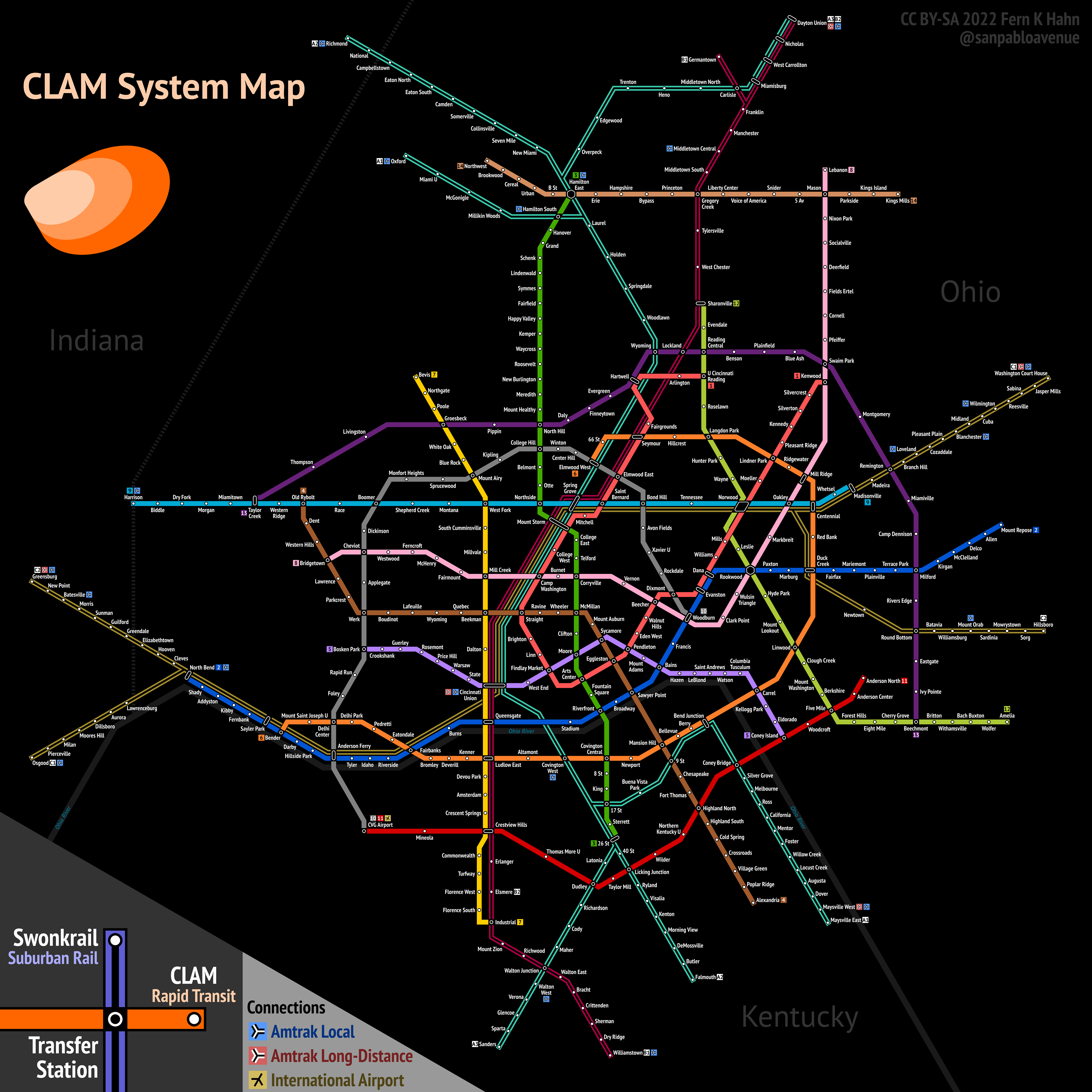
Cincinnati | February 2022
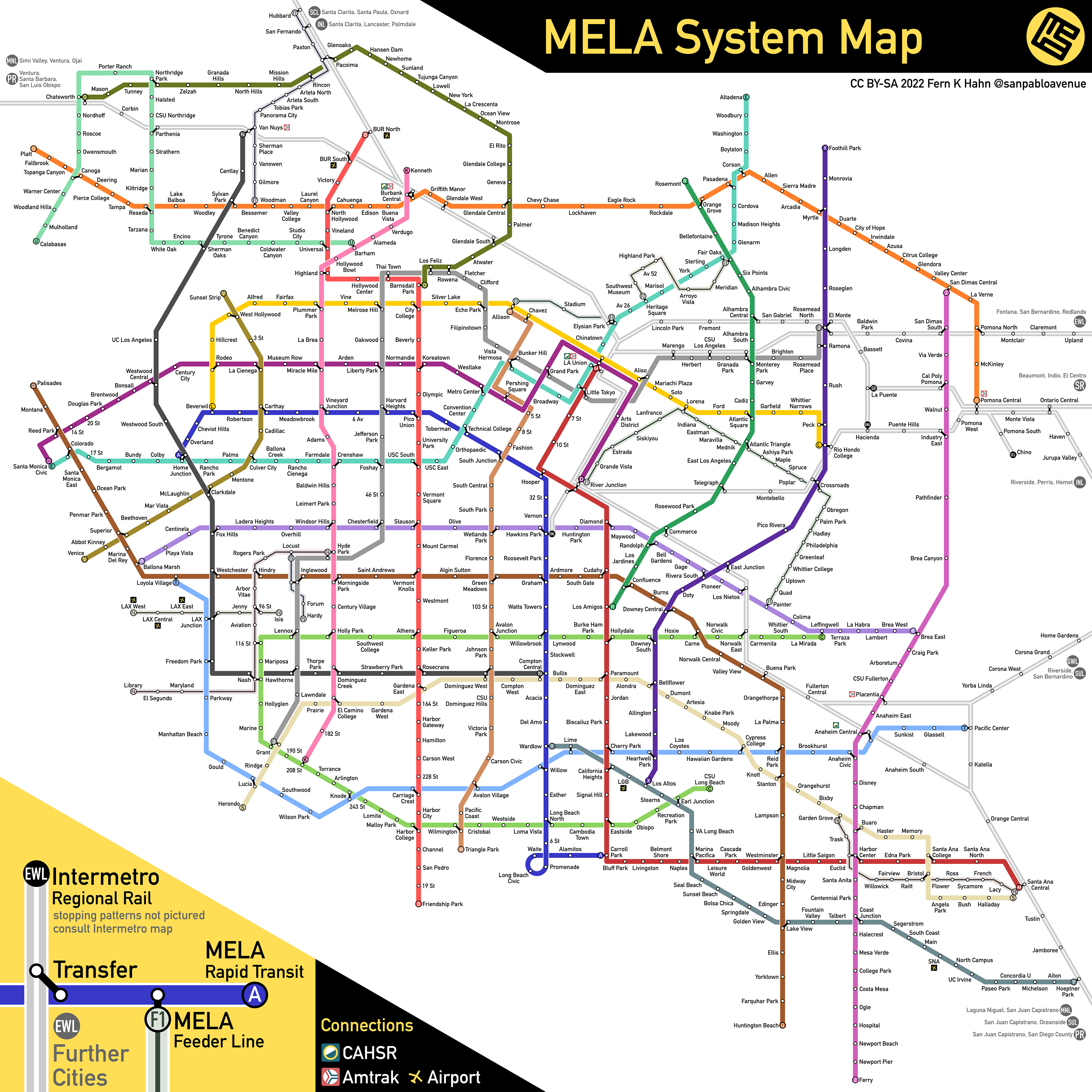
Los Angeles | January 2022
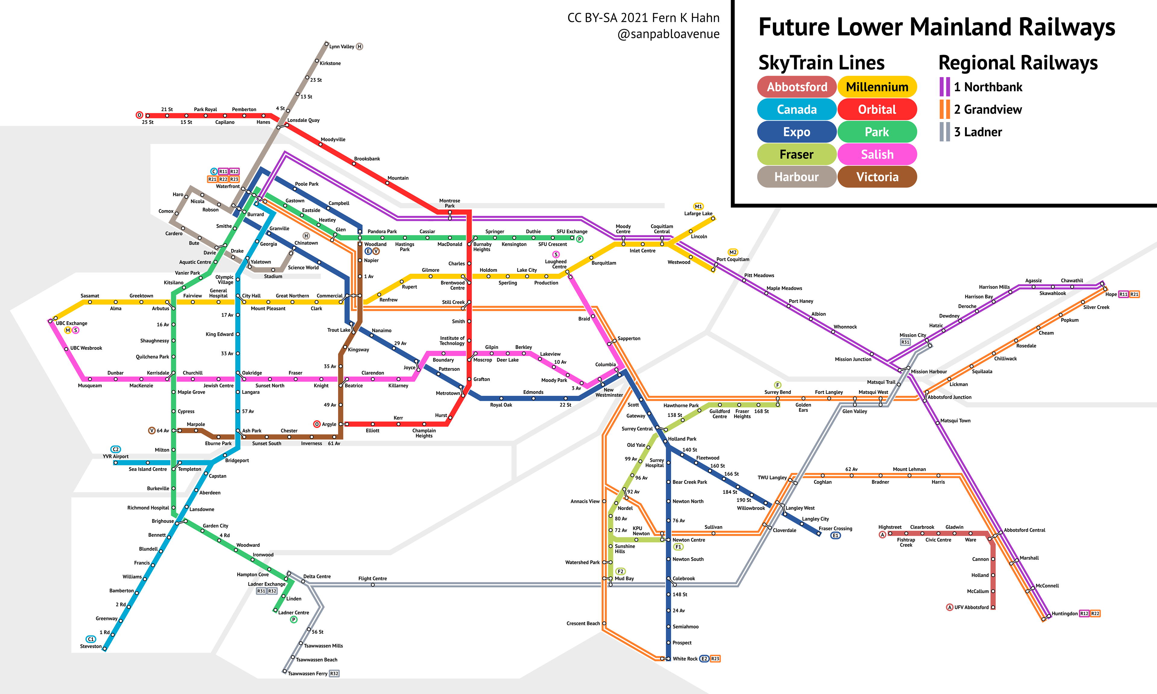
Vancouver | November 2021
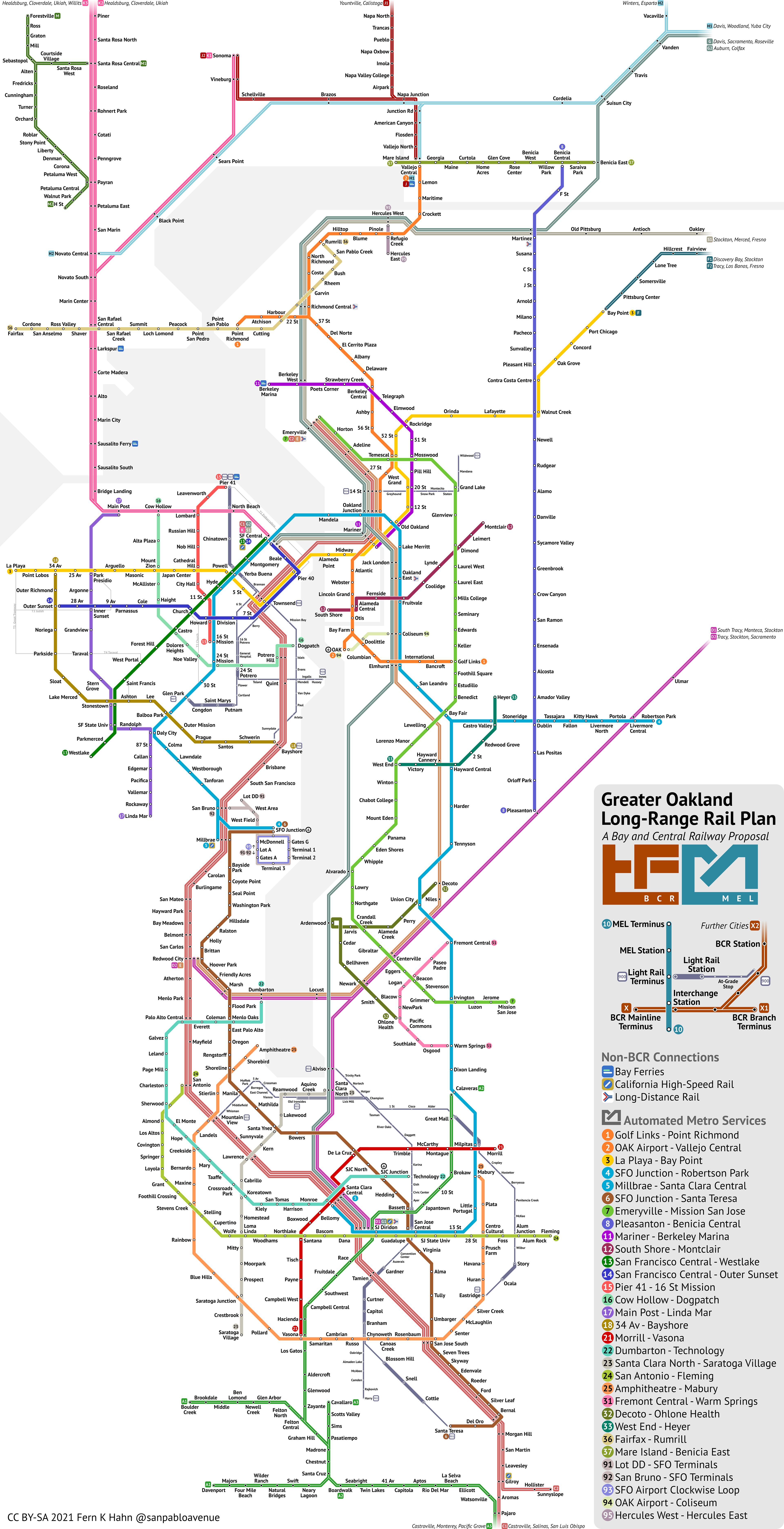
San Francisco Bay | September 2021