

What is this?
Denver's Regional Transportation District is among the largest transit agencies in the US with no official system overview map. Their website provides one of those GIS maps whose utility is limited to showing where buses may appear at least once a week — no distinction between routes, no indication of service span or quality. In addition to this gap in passenger information material, Denver's moderate size and regular street grid made it an attractive canvas for my first attempt at bus system map design.
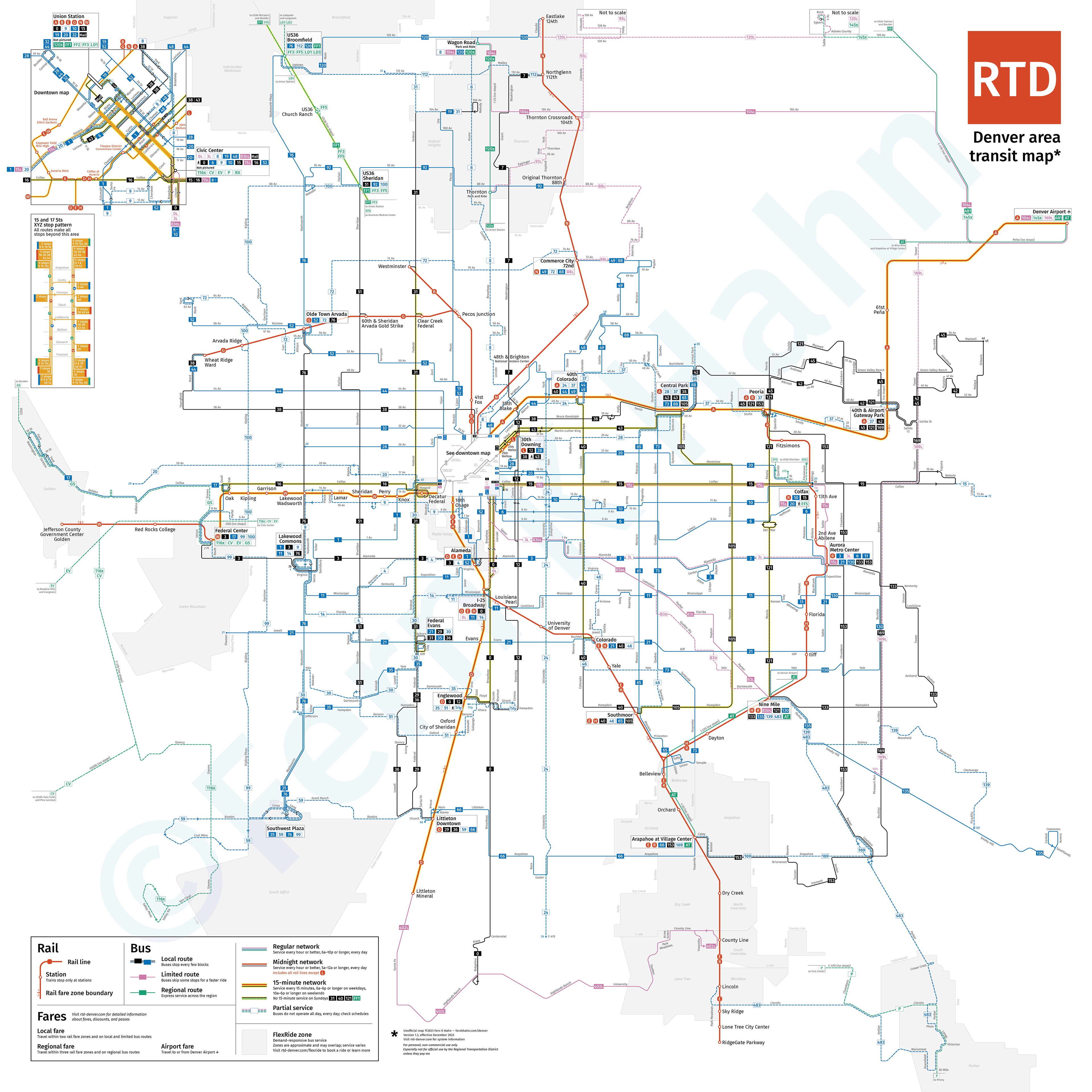
Denver transit map effective December 2023
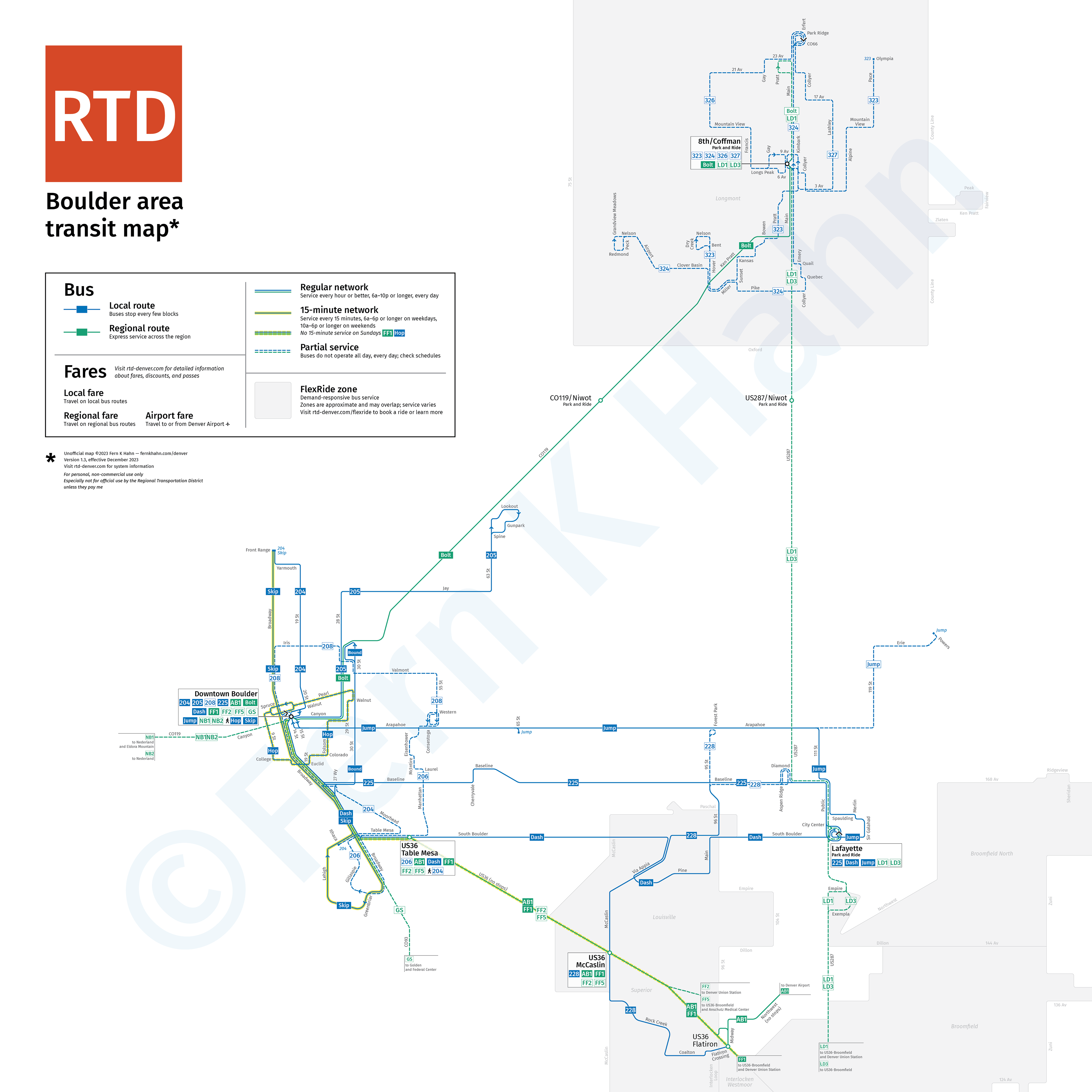
Boulder transit map effective December 2023
Click images to expand; click here for PDF
Updates
2023-12-05: added FlexRide demand-responsive transit zones
2023-12-19: finally added Boulder
What's missing
Future versions of this map may include landmarks such as parks, hospitals, postsecondary institutions, shopping centres, and the Platte River. I may also create a map of the regional bus network, but no promises made.
Also, I made this for free, and it is intended strictly for personal use. RTD can contact me if they want to use this map or anything derived from it.